Project Innerspace launches GeoMap geothermal prospecting tool for North America
Project Innerspace has announced the release of the North America Module for GeoMap, a freely available and interactive geothermal prospecting tool.
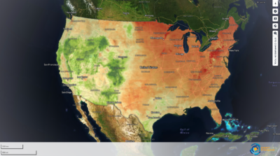
Project Innerspace has launched a new North American dataset in its Geothermal Exploration Opportunities Map (“GeoMap™”) tool. With this update, the tool can now be used to provide insight on untapped clean geothermal potential in previously overlooked regions in North America, including within the central US, portions of the eastern seaboard, into the NW Territories of Canada, and across parts of Mexico.
The update follows up on the Beta launch of GeoMap™ back in December 2023, which mainly focused on the African continent as the first case study. Developed in collaboration with Google, this innovative, freely accessible, first-of-its-kind geothermal exploration tool aims to better inform the worldwide expansion, development, and deployment of next-generation clean geothermal energy.
The freely accessible GeoMap™ tool can be accessed via this link. A workshop on the North America module will also be held on the 5th of June 2024 at 9:00 AM CT. Click here to RSVP.
New features
The North America region of GeoMap™ includes some unique and enabling features including more than 150 layers of subsurface and surface data, with many never before used layers for geothermal prospecting. GeoMap allows users to explore and rank geothermal development opportunities utilizing factors like state and county boundaries, pollution point sources, transmission lines, heat and electricity demand, regulatory incentives, and techno-economic considerations.
GeoMap™ now comes with a new site comparison tool which enables users to compare facilities of interest to determine which sites, whether that be coal plants, industrial facilities, military bases, and the like, are best suited to utilize next-generation geothermal energy.

By pulling together all of these different layers of information into one interactive resource, GeoMap™ can help all stakeholders – from policymakers, industry, project developers, and interested citizens – to envision where the best opportunities for geothermal development are in their communities.
GeoMap will continue with its rollout in other continents with Asia due by the end of 2024, South America by early 2025, and the rest of the world to be completed throughout 2025.
Source: Email correspondence


